Daily Progress Report
While computer vision models can be trained to quickly identify areas of the rainforest that have been significantly damaged, signs of deforestation can be challenging for a computer to see at first. It takes human eyes to properly classify images in order to build models that can detect the subtle differences between satellite imagery. For every image that you select as an area of deforestation in our crowdsourcing project, SAS and our partners get closer to building a model that can alert governments and conservation organizations.
From Earth Day, April 22, 2020, through February 2021, citizen scientists like yourself across 95 countries have classified nearly 90,000 satellite images of the Amazon rainforest. The results can be reviewed here.
Our work is not finished. From March 2021 on, we will continue combining SAS AI technology, your human input, and our partner’s expertise to identify where changes are occurring over time. This could one day help predict where deforestation is likely to happen next.
Note: The results below are based on crowdsourced consensus, meaning multiple agreements from citizen scientists like yourself are required to be reflected as one result. The results are provided in the charts below, which are updated twice daily.

Human Impact
No Human Impact
Recent Human Impact
Not Yet Classified
Current Assessments
We currently have thousands of satellite images that need to be classified through crowdsourcing to help detect human impact changes in the Amazon. Here’s our progress and how much more we need to do.
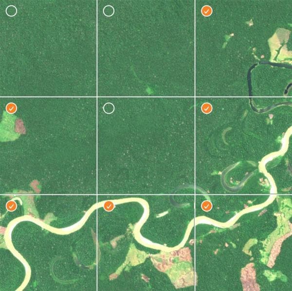
Classification Map
Based on previous input, this map shows smaller areas of the Amazon rainforest where we are focusing efforts to identify more recent deforestation. By using image data from this ecologically diverse territory, we are giving our model a wide variety of examples so that it can one day learn to detect human impact anywhere in the Amazon. Here's our current progress to date.
Human Impact
No Human Impact
Recent Human Impact
Not Yet Classified
Current Area Coverage
Over the full course of this project, we will evaluate more than 1.2 million square kilometers, including our current project goal to evaluate 450,000 square kilometers of the Amazon. Here's our current project progress to date.
Compatible con dispositivos móviles Apple y Android, y con los siguientes navegadores:
- Chrome (versión 80 o superior)
- Edge (versión 41 o superior)
- Firefox (versión 75 o superior)
- Safari (versión 10 o superior)
