How It Worked
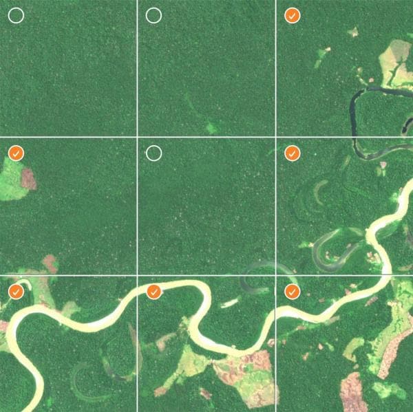
While computer vision models can be trained to quickly identify areas of the rainforest that have been significantly damaged, signs of deforestation can be challenging for a computer to see at first. It takes human eyes to properly classify images in order to build models that can detect the subtle differences between satellite imagery.
From Earth Day, April 22, 2020, through February 2021, citizen scientists classified nearly 90,000 satellite images of the Amazon rainforest in phase one of the project. Every image that volunteers selected as an area of deforestation in our crowdsourcing project got SAS and our partners closer to building a model that can alert governments and conservation organizations.
During the second phase, which started March 2021, we continued combining SAS AI technology, human input and our partner’s expertise to identify where changes are occurring over time. This could one day help predict where deforestation is likely to happen next.
Note: The results below are based on crowdsourced consensus, meaning multiple agreements from citizen scientists were required to be reflected as one result. The results are provided in the charts below.
Human Impact
No Human Impact
Recent Impact
Not Yet Classified
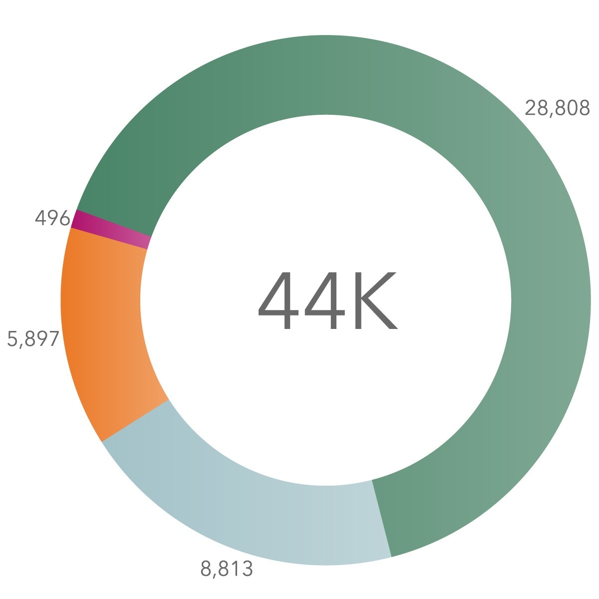
Image Assessments
Through crowdsourcing, citizen scientists from 110 countries helped identify human impact in 90,000 satellite images of the Amazon rainforest during phase one.
In phase two, the goal was to classify 45,000 more images to identify recent human impact in these areas. Here are the results of that second phase.
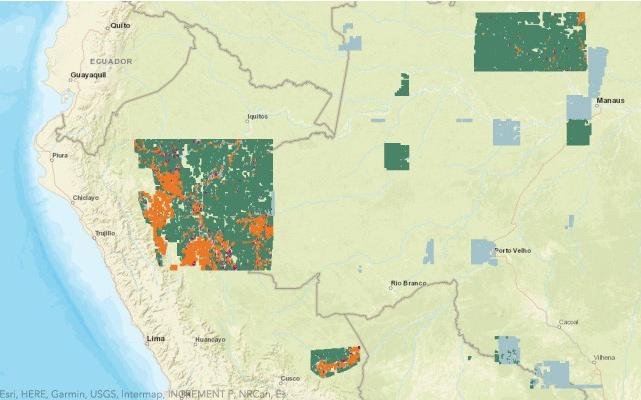
Classification Map
Based on previous input, this map shows smaller areas of the Amazon rainforest where we focused efforts to identify more recent deforestation. By using image data from this ecologically diverse territory, we gave our model a wide variety of examples so that it can one day learn to detect human impact anywhere in the Amazon. Here are the results from phase two.
Human Impact
No Human Impact
Recent Impact
Not Yet Classified
Sq. km evaluated
1,047,996
Area Covered
Over both phases of this project, the goal was to evaluate more than 1 million square kilometers of the Amazon, including 700,000 square kilometers from phase one, plus 400,000 square kilometers in phase two. And the citizen scientists using our app came through.
