GREMOVE Procedure

Example 2: Creating an Outline Map of Africa
| Features: |
PROC GREMOVE options DATA= and OUT= |
| Other features: |
GMAP procedure |
| Sample library member: | GRMAFRIC |
This example processes
the MAPS.AFRICA map data set, supplied with SAS/GRAPH, to produce
a new map data set that contains no internal boundaries. This is
done by adding a new variable, REGION, to the map data set and setting
it equal to 1. Unit areas from the input map data set that have the
same BY-variable value are combined into one unit area in the output
map data set.
The MAPS.AFRICA Data Set shows some of the variables that are present in the original
map data set:
The MAPS.AFRICA Data Set
MAPS.AFRICA Data Set
OBS ID SEGMENT X Y
1 125 1 0.57679 1.43730
2 125 1 0.57668 1.43467
3 125 1 0.58515 1.42363
.
.
.
3462 990 1 1.04249 0.50398
3463 990 1 1.04184 0.50713
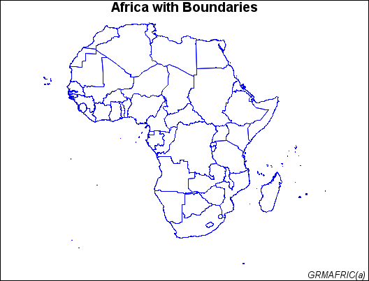
3464 990 1 1.04286 0.50841Map Before Removing Borders (GRMAFRIC(a)) shows the map before processing:
The new AFRICA map
data set is created with a new variable, REGION. The AFRICA Data Set shows the variables that are present in the new map data
set created by the GREMOVE procedure:
The AFRICA Data Set
AFRICA Data Set
OBS X Y SEGMENT REGION
1 0.24826 1.02167 1 1
2 0.25707 1.02714 1 1
3 0.26553 1.03752 1 1
.
.
.
982 1.19071 1.30043 3 1
983 1.18675 1.30842 3 1
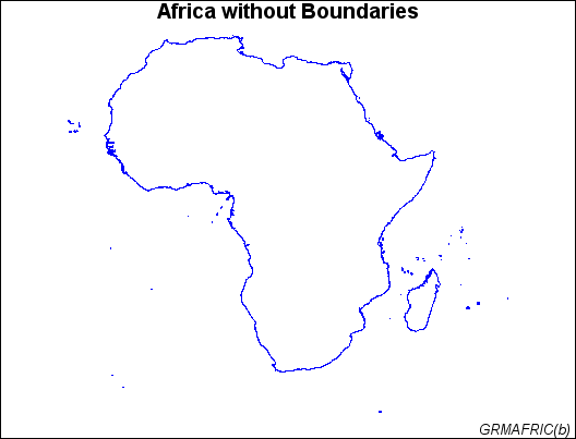
984 1.18518 1.32822 3 1Map After Removing Borders shows the new map after PROC GREMOVE has removed all of
the interior boundaries:
Program
goptions reset=all border;
data newaf;
   set maps.africa;
   region=1;
run;
proc gremove data=newaf out=africa;
   by region;
   id id;
run;
title "Africa with Boundaries";
footnote j=r "GRMAFRIC(a) ";
pattern value=mempty color=blue;
proc gmap map=maps.africa data=maps.africa all;
   id id;
   choro id / nolegend levels=1;
run;
title "Africa without Boundaries";
footnote j=r "GRMAFRIC(b) ";
proc gmap data=africa map=africa;
   id region;
   choro region / nolegend levels=1;
run;
quit;
Program Description
Create the NEWAF data set. This
new map data set contains all the variables in the MAPS.AFRICA map
data set supplied with SAS/GRAPH plus the added variable REGION.
Remove the unit areas from the AFRICA data set. DATA= specifies the input map data set and OUT=
specifies the output map data set. The input map data set has a variable
called REGION that is used as the BY-variable to identify the new
unit areas. The ID statement specifies the current unit areas from
the input map data set.